Technological infrastructure
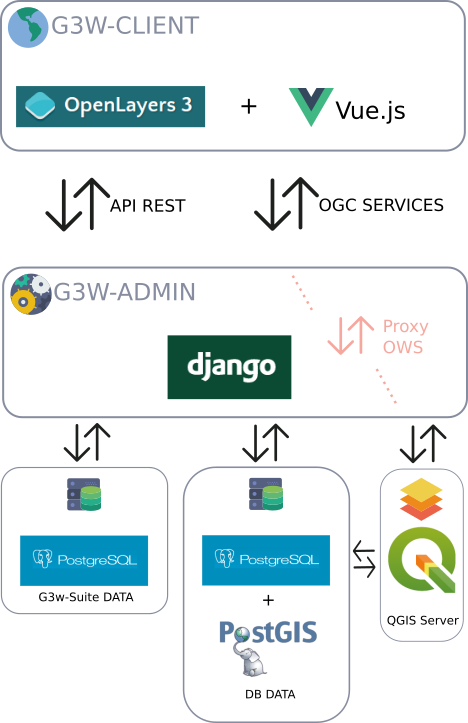
The publishing system is based on a series of OS tools and software
PostgreSQL/PostGis: for the management of application dataPostgreSQL/PostGisorSpatiaLite: for the management of geographic dataQGIS Server LTRas OGC services serverG3W-ADMIN- the Administration component: developed inPythonusingDjangoG3W-CLIENT- the Cartographic client: based onOpenLayers3and developed with reactive tecnology byVue.jsThe main libraries used for the management and the visualization of the geographical part and the interaction with the user are:
OpenLayer, Boostrap, jQuery, LodashandVue.js.Gulp.jsas task runner
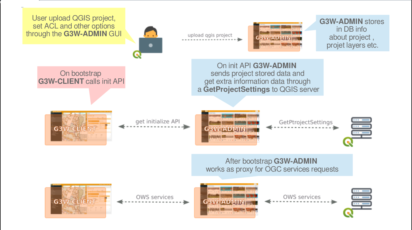
Below is a diagram relating to the standard workflow