QGIS: project settings
This section describes how to optimize your QGIS projects to publish as a WebGis service.
Thanks to the integration with QGIS Server, all the symbology aspects associated with the singoly layers are automatically reproduced on the WebGis service
In the QGIS cartographic projects you can set some parameters and options that affect functionalities and contents in the derivative WebGis service, such as:
the webgis service identification name
the associated basic metadata
the capabilities of the service
the possibility to exclude some associated print layouts on the WebGis service
which layers are queryable and searchable
which layers to expose with the different OGC services (WMTS, WFS, WCS)
which fields (for each vector data) are exposed as WMS and/or WFS
the Themes (Views) defined at the project level
the structure of the query form visible on the WebGis service
the editing widget, constraints** and default values dor every fields of vector layers
the associated print layouts, report included
The following paragraphs describe which QGIS project settings are more relevant in relation to the published WebGis service.
Project property
From the Project → Properties menu, you can access the Project Properties window and the three submenus of our interest:
General
Data sources
QGIS server
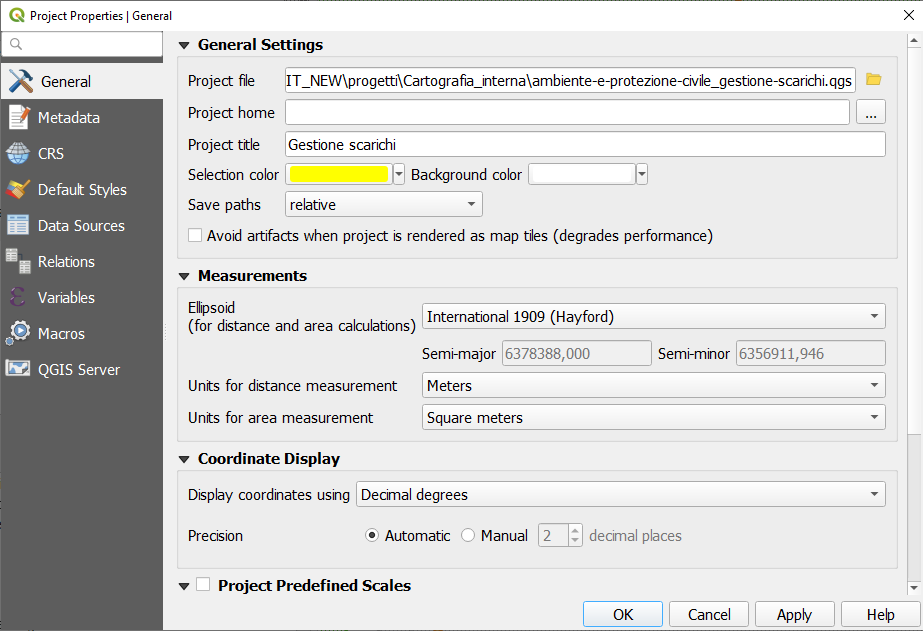
General
General Settings
In this section it is possible to define the title of the project, consequently the title of the WebGis service.
This title will be used at the G3W-SUITE application level to uniquely identify the published project; for this reason it will not be possible to assign the same name to different projects published on the WebGis service.
We advise against using special characters, or numbers in the project name.
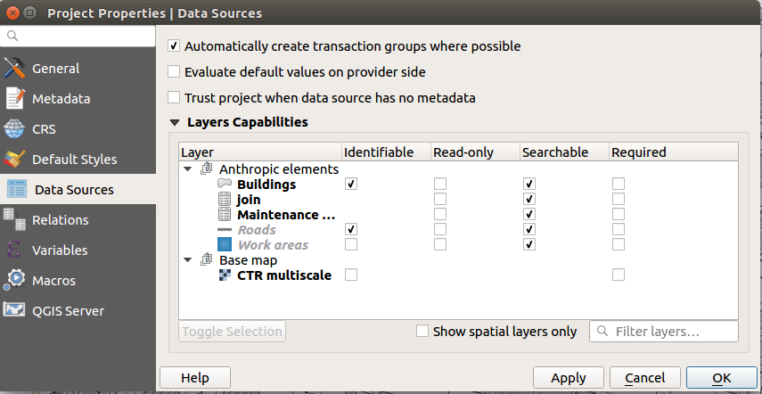
Data sources
The option Automatically create transaction group where possible is automatically inherited in the online editing function.
Layers Capabilities
This submenu defines the querable and/or searchable layers at the WebGis service level.
Check the
Identifiablecolumn if you want that the layer will be searchable on the WebGisCheck the
Searchablecolumn if you want that the layer will be querable on the WebGis
NB: this differentiation is only possible by using the QGIS APIs such as Search URL endpoint. See dedicated paragraph
QGIS Server
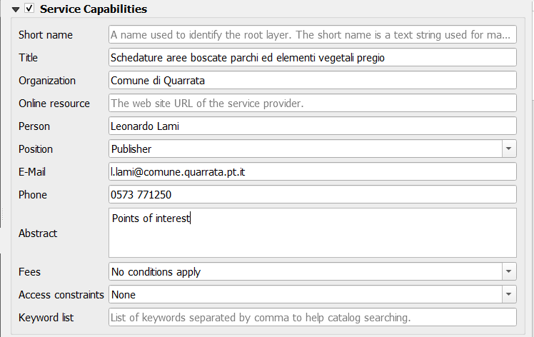
Service capabilities
In this section it is possible to define the capabilities of the service.
This information, together with info about the structure of the attribute tables of the layers present in the project, will be displayed in the Metadata session of the cartographic client.
See also dedicated paragraph
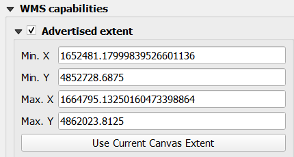
Capabilities WMS - Advertised extent
In this section it is possible to define the geographical extension displayed when the WebGis service starts.
To define it, set the desired geographical view on the map and then click on the ‘Use Current Canvas Extent’ button.
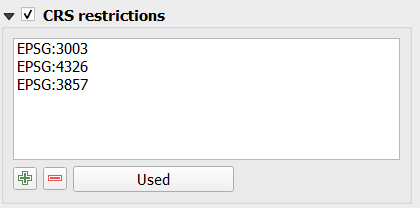
WMS Capabilities - CSR restrictions
In this section it is possible to define the projection systems for which the project is available in relation to OGC services.
It is clearly necessary to insert the projection system on which the project was made, this SR is added by clicking on the ‘Used’ button.
Other geographic reference systems can be implemented by clicking on the ‘+’ button and choosing from the list of reference systems.
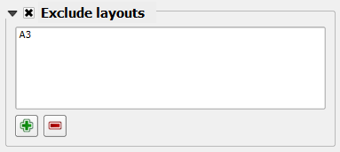
Capabilities WMS - Exclude layouts
In this section it is possible to exclude some of the print layouts that are associated with the cartographic project from the availability of the WebGis service.
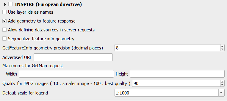
Capabilities WMS - General aspects
Two further aspects are manageable with regard to WMS capabilities
in general it is recommended to check
use the layer ids as namesoptionthe option
Add geometry to feature responsemust be checked to activate the zoom to the features on the WebGis service
WMTS Capabilities
In this section it is possible to define which layers are exposed as WMTS services defining the various options
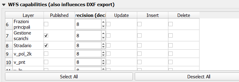
WFS Capabilities
In this section it is possible to define which layers are exposed as WFS services.
The WFS service is needed if you want activate following types of query:
bbox query
bypolygon query
It is sufficient to check only the Published column
WCS Capabilities
In this section it is possible to define which rasters are exposed as WCS services
General aspects
Themes (Views)
The creation of Themes (combination of off / on layers and differentiated simbology styles) is managed at the WebGis service level.
A specific menu on the webgis will allow you to choose the Theme to be displayed.
Layer order
The option to define the layer order different from the order in the TOC on the QGIS project is automatically supported.
Legend
The activation of the Filter legend by Map content option on the QGIS project is automatically applied to the derived WebGis service.
Groups of layers
The activation on the QGIS project of the Mutually exclusive group option for the layers groups is automatically applied to the derived WebGis service.
Layers properties
Simbology
The rendering style associated with the individual layers is replicated autonomously on the WebGis service.
If external SVG icons are used (added to the basic ones of QGIS, via the Settings -> Options -> System -> SVG paths), these must be uploaded to the server (through the File Manager tool) in order to be used by QGIS Server.
Layer style
The suite manages the presence of multiple styles associated with a layer.
It will be possible to dynamically choose the style on the cartographic client.
It will be possible to manage the styles associated with a layer from the Administration component, also by loading .qml file styles and setting the default style among those present.
Manage custom SVG icons
In the installation procedure of the G3W-SUITE application, an svg named directory is created on the server.
Within this directory it is therefore possible to store SVG icons, also organized in subdirecory.
The Configurations icon  , located in the upper right corner of the Administration Panel, allows you to access a menu that includes the
 File Manager item.
![]()
Through this tool it is possible to manage SVG icons on the server in a simple and intuitive way.
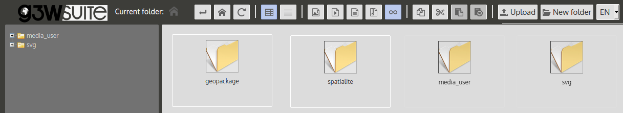
The SVG folder on the server must reflect the structure in any subfolders present locally.
NB: The name of this directory is defined by the basic settings set during the installation of the suite. See dedicated paragraph.
PS: remember that the File Manager tool also allows you to manage the synchronization of geographical data (in the case of using physical files) and the management of multimedia files.
See also dedicated paragraph
Definition of the fields that can be consulted for each layer
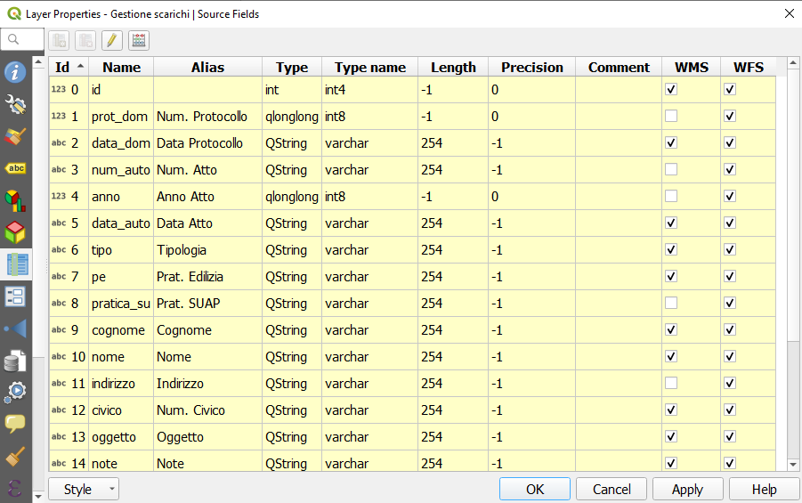
Within the QGIS project it is also possible to define, for each layer, which fields are available following query on the WebGis service.
To define these settings, you access the properties of one of the vectors previously defined as searchable and choose the Source Fields submenu in the Layer Properties window.
This submenu lists the fields associated to the table of the vector.
The check box relating to the WMS column defines whether or not the values contained in this field will be available following the query on the WebGis service.
Viewing multimedia content
Multimedia contents (images, pdf, web URL …) can be viewed interactively on the map client following publication of the QGIS project.
In the case of web links, simply insert them (preceded by the prefix http:// or https://) within the dedicated attribute fields
In the case of multimedia files it is necessary:
upload the media file to the
media_userfolder (folder exposed on the web) accessible through theFile Managertool in the Suite Administration Panelinsert the web link to this file in the dedicated attribute field
The link to the file can be obtained in the following way:
application domain + media_user + path of the file + file name
Example:
application domain:
https://dev.g3wsuite.itfile
file_A.pdflocated in the folder/media_user/form/web link:
https://dev.g3wsuite.it/media_user/form/file_A.pdf
Following queries at the cartographic client level, we will have different behaviors based on the type of content:
image: preview display in the form, click on the preview to display the image in real size
web link or other multimedia file: display of an Open orange button to allow consultation of the content
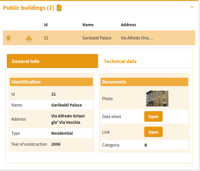
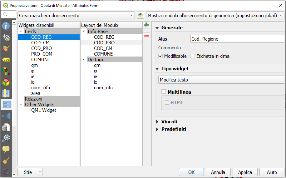
Definition of the attribute display form
For each layer it is possible to define the structure of the attributes form associated with displaying the results following query operations.
On QGIS we can build a personalized form (query form) by creating thematic tabs and groups and defining the distribution of the individual fields and their aliases.
This structural organization will be replicated directly on the query form on the WebGis service.
Print layouts
Any print layouts associated with the published QGIS project will automatically be associated with the published WebGis service.
Print layouts can contain more than one Map items and panoramic maps.
Atlas and report are also supported.
Any images present in the print layouts must be placed in the local project_data folder (in any subdirectory) and synchronized on the server.
See also the dedicated paragraph Geographic data synchronization on the server.
Performances optimization
Mandatory rules
PostGreSQL/PostGis, SQLite/Spatialite and GeoPKG layers must have a primary key
not use numeric type field in PostGreSQL/PostGis layer
the primary key field and all fields involved in search, join, 1:n relation or editing function have to be published as WMS
don’t use commas for aliases associated with layers
style settings defined at the auxiliary data level are not supported
Tips
when using rule-based/categorized classification create indexes on the column(s) involved in the rule expression
start the project with only a few layers turned on by default
do not exceed three nesting levels in the groups of layers defined in the TOC