Management and organization of geographic data and QGIS projects
This section describes how to organize QGIS data and projects locally and how to synchronize them on the server environment for publication purposes
Thanks to the integration with the APIs of QGIS it is now possible to manage the main formats (geographically and not) supported by QGIS Server:
reading and editing mode
PostGreSQL/PostGis
SQLite/SpatiaLite
GeoPackage
ShapeFile
reading mode
SQL Server
Virtal layer
The suite also allows you to manage 1:N relational editing.
Data on DB Server
If your geographical data are stored on Server DB, it will be sufficient to allow access to the DB from the IP address on which the application is installed.
Data on SpatiaLite or OGR format
If your geographical data are stored on SpatiaLite or on physical files (.gpkg, .shp, .kml, .tif …) located on your local PC, you will need:
organize data and projects in predefined localy directories and subdirectories
upload/synchronize geographic data to the corresponding folder located on the server where the application is installed
Of course, mixed solutions with geographical data on PostGreSQL/PostGis, SpatiaLite and other formats will also be possible.
Organization of data and projects
Data on physical files and / or on GeoDB SpatiaLite and QGIS cartographic projects must be organized in compliance with the following indications:
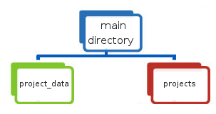
a main directory named and positioned in according to need’s user
a
project_datasub-directory that must contain the geographic data used for the various cartographic projects, such data can also be organized in subdirectories with no nesting limits.a
projectssub-directory that must contain the QGIS cartographic projects (.qgz or .qgs files)
NB: The name of the local directory dedicated to geographic data must correspond to the name defined for the DATASOURCE_PATH variable set during installation.
See dedicated paragraph.
That directory is also used to contain images used in the print layouts associated with the QGIS cartographic projects.
Geographic data synchronization on the server
The data stored in the local project_data directory must be synchronized on the server where the G3W-SUITE application is installed.
The geographic data stored in the local project_data folder must be loaded, reflecting any subdirectory structure.
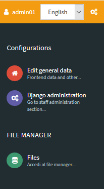
To synchronize your data access to the Administration panel of G3W-ADMIN and click on the Configurations icon  located in the upper right corner.
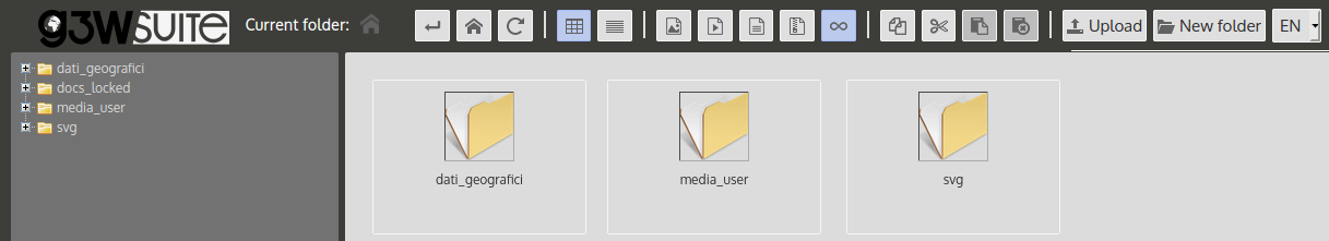
Choose the File Manager item in the linked menu.
![]()
Using this tool it is possible to manage the physical geographic data on the server in a simple and intuitive way.
This the directories present by default:
project_data: the folder in which to store the geographical data and any images inserted in the print layoutsmedia_user: a folder exposed on the web, to store your multimedia filessvg:a folder to store extra SVG icons used your QGIS projects
All the folder can be organized in subdirectories with no nesting limits.
NB: The names of these directories are defined by the basic settings set during the installation of the suite. See dedicated paragraph.