Gestione ed organizzazione dati geografici e progetti QGIS
In questo paragrafo si descrive come organizzare dati e progetti QGIS in locale e come sincronizzarli sull”ambiente server ai fini della pubblicazione.
Thanks to the integration with the APIs of QGIS it is now possible to manage the main formats (geographically and not) supported by QGIS Server:
reading and editing mode
PostGreSQL/PostGis
Oracle Spatial (compiling QGIS Server)
SQLite/SpatiaLite
GeoPackage
ShapeFile
reading mode
SQL Server
Virtual layer
The suite also allows you to manage in consultation ed editing:
simple join data with no nesting limits
1:N relation data
N:M relation data
Dati su DB Server
Nel caso i dati geografici utilizzati per realizzare i vostri progetti cartografici QGIS siano situati su Server DB, sarà sufficiente permettere l’accesso al DB dall’indirizzo IP su cui è installato l’applicativo.
Data on SpatiaLite/GeoPackage or OGR format
If your geographical data are stored on SpatiaLite, GeoPackage or an other physical files (.shp, .kml, .tif…) located on your local PC, you will need:
organizzare dati e progetti in directory e sottodirectory locali predefinite
uploadare/sincronizzare i dati geografici sulle corrispondenti directory poste sul server di installatazione dell”applicativo
Naturalmente saranno possibili anche soluzioni miste con dati geografici su PostGreSQL/PostGis, SpatiaLite ed altri formati.
Organizzazione dati e progetti
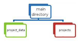
Dati su file fisici e/o su GeoDB SpatiaLite e progetti cartografici QGIS devono essere organizzati nel rispetto delle seguenti indicazioni:
una directory principale nominata e posizionata secodo l”esigenze dell”utente e contenente
una sub-directory
project_datache deve contenere i dati geografici utilizzati per i vari progetti cartografici, tali dati possono anche essere organizzati in ulteriori sub-directory senza limiti di nidificazione.una sub directory nominata
projectsche ospiterà i progetti QGIS da pubblicare.
NB: il nome della directory locale dedicata ai dati geografici deve corrisponde al nome definito per il set di variabili DATASOURCE_PATH durante l”installazione. Vedi paragrafo dedicato
Tale directory è adibita anche a contenere immagini utilizzate nei layout di stampa associati ai progetti cartografici QGIS.
Sincronizzazione dati geografici su spazio server
The data stored in the local project_data directory must be synchronized on the server where the G3W-SUITE application is installed.
The geographic data stored in the local project_data folder must be loaded, reflecting any subdirectory structure.
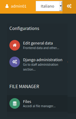
To synchronize your data access to the Administration panel of G3W-ADMIN and click on the Configurations icon  located in the upper right corner.
Choose the File Manager item in the linked menu.
![]()
Tramite tale strumento è possibile gestire i file fisici geografici sul server in modo semplice ed intuitivo.
The root directory of the File Manager corresponds to the local project_data directory
It will therefore be necessary, in the case of using geographic files on the file system, to synchronize the contents of the local project_data directory (and any sub-directories) before proceeding with the publication of QGIS projects.
Two specific directories can also be created within the root directory of the File Manager:
media_user: a directory exposed on the web, to store your multimedia filessvg:a directory to store extra SVG icons used your QGIS projects
All the directories can be organized in subdirectories with no nesting limits.
NB: i nomi di queste directory sono definiti dalle impostazioni di base impostate durante l”installazione della suite. Vedi paragrafo dedicato
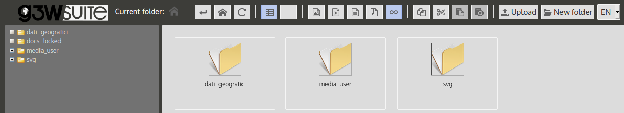
The example shows the case in which in the local project_data directory there are two directories (geopackage and spatialite) in addition to the two system directories (svg and media_user).