Introduction
G3W-SUITE is a modular client-server application for the management and publication of interactive map projects.
The framework was born from the need to have a software capable of publishing, in total autonomy and in a simple and fast way on a webgis client, cartographic projects realized with QGIS.
The following aspects will be analyzed within the manual:
organization and optimization of data and QGIS projects for web publishing
organization of cartographic contents in a hierarchical way: macro groups and cartographic groups
user management and access control systems for consultation and management of webgis services
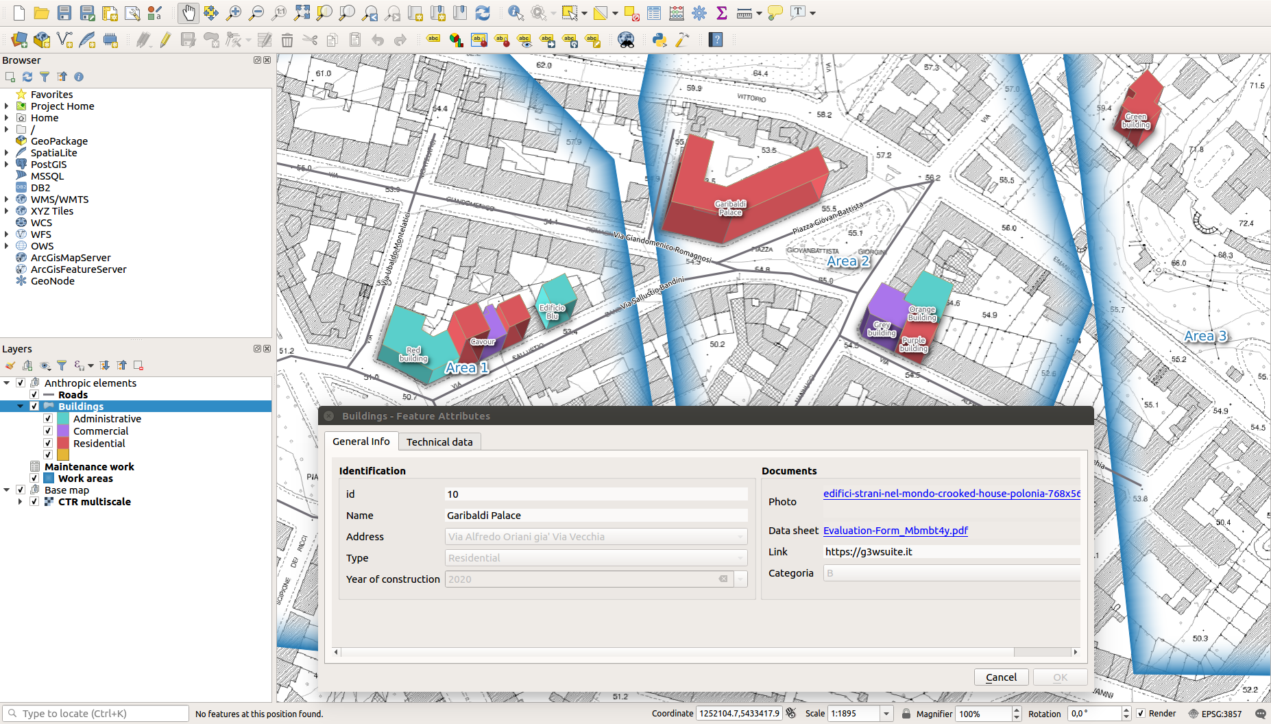
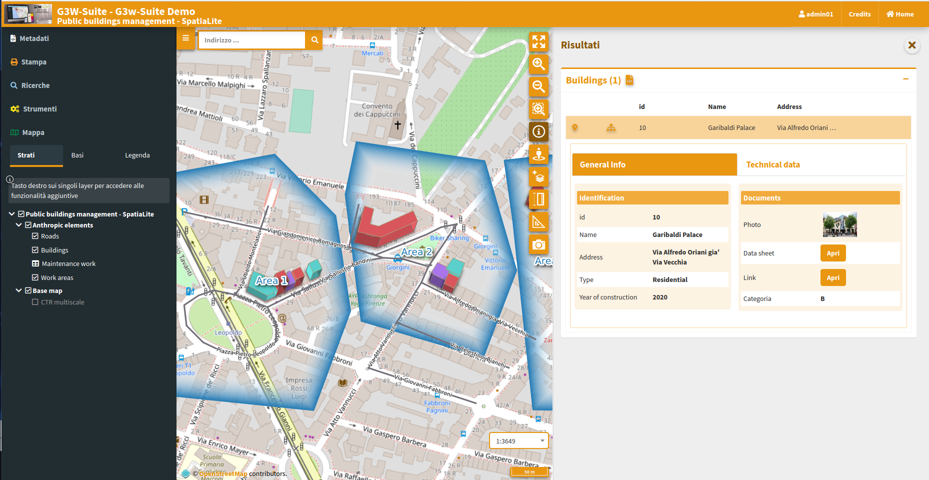
management of the online editing function for the creation of web cartographic management systems
publishing and managing QGIS projects as WebGis services
creation of searches, visualization of graphics created with the DataPlotly plugin and definition of constraints (geographic and alphanumeric) on visualization and editing permissions
The current release (3.4) is compatible with QGIS 3.22.x LTR (Server and Desktop).
Version
At the moment it’s not used a classic versioning system for the suite, this branches are avialable.
| Branch | Python version | Django version | QGIS | QGIS API | Status |
|---|---|---|---|---|---|
| dev | 3.6 | 2.2 | 3.22 | Used | Continuous development |
| v3.4 | 3.6 | 2.2 | 3.22 | Used | Bug fixing |
| v3.3 | 3.6 | 2.2 | 3.16 | Used | Bug fixing |
| v3.2 | 3.6 | 2.2 | 3.16 | Used | Not longer supported |
| v3.1 | 3.6 | 2.2 | 3.10 | Used | Not longer supported |
| v3.0 | 3.6 | 2.2 | 3.10 | Used | Not longer supported |
Main contributors
Walter Lorenzetti - Gis3W (@wlorenzetti)
Leonardo Lami - Gis3W (@leolami)
Francesco Boccacci - Gis3W (@volterra79)
Alessandro Pasotti - QCooperative (@elpaso)
Luigi Pirelli - QCooperative (@luipir)
Mazano - Kartoza (@NyakudyaA) (Dockerization refactoring)